NMSU geographers map Mesilla Valley Bosque State Park

When Mesilla Valley Bosque State Park offered up its facility so New Mexico State University could host a dinner event there last fall, geographers offered to map the boundary of the park as a "thank you" in return.
The College of Arts & Sciences held part of the annual Southwest Division of the Association of American Geographers at the state park in October 2012.
"The state park does not really have any mapping capabilities," said Randy Carr, coordinator for the Spatial Applications and Research Center (SpARC). "We offered to help them with some mapping and GIS support of the park so they can better manage and inventory their resources because they let us use their facility."
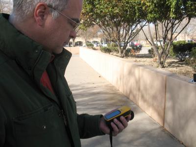
Though most work done for mapping is conducted in the SpARC lab, Carr had a geography technician go to the park to walk the trails to get boundary details not available to them through aerial photography.
Geographers also met with Jan Kirwan, park superintendent, to find out what specifically they wanted out of the project, which included an overall map of the park, archaeological sites that have not been excavated, and boundaries for properties adjacent to the park.
"This is an amazing management tool for us," Kirwan said. "Because of this effort, we can easily identify what projects we are working on, such as trail work or restoration, where we are working on them, and where our projects might overlap. This is a nice tool for our toolbox to help us manage and document what we are doing at the park and so we can move forward with those projects.
The state park is currently about 340 acres along the west bank of the Rio Grande. The goals of the park include restoring the wildlife and native plant communities and protecting the natural environment and cultural resources; attracting the public to participate in outdoor recreation; and educating children and adults about the wildlife and native plants along the Rio Grande.
Kirwan said this mapping not only benefits state park officials but they also can use the data they gather for educational and presentation purposes for the public to show people what the park has to offer.
Along with a large printout of the map showing public information that will be displayed at the park, NMSU will also provide digital maps and a geographic database that will allow park officials to update the information as they conduct work around the area, and also create custom maps depending on their needs, such as maps of nature trails to hand out to the public.
NMSU's services also include training and support of the software required to fully utilize the data gathered.
"Most of what SpARC does is contract work," said Carr, "but we do seek out community outreach opportunities and that is how this project came to happen."
"Not only do we want this to be an ongoing project with the Mesilla Valley Bosque State Park, but we also want to include them in a larger project to coordinate all the GIS users in the Southern New Mexico region so we can more easily share data and information," Carr said.


